Tuesday, April 3, 2012
DOQQ Map
http://www.lacoast.gov/maps/2005doqq/
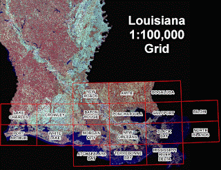
A DOQQ Map stands for a Digital Orthophoto Quarter Quad map and are usually produced by the USGS from digital aerial photos. These maps are especially important in that they remove the distortion of areal photos and provide a clean and neat flat map that accurately measures variables such as distance and area. This particular map shown here is of the 2005 Louisiana Cost, taken aerially, after the Hurricanes Rita and Katrina hit the coast. Maps such as these are useful in depicting the areas most influenced by the Hurricanes, and where efforts should be concentrated in order to continue seeing results.
Subscribe to:
Post Comments (Atom)

No comments:
Post a Comment