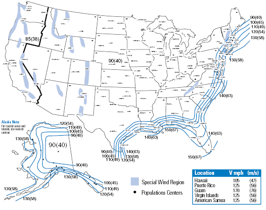
An isotach is a line found on a typical weather map that connects points where equal wind speeds have been recorded. The map pictured above depicts the wind speeds found at approximately 33 ft above ground throughout the United States of America (both the continuous states, as well as Alaska, Hawaii, and other territories). The values that are shown were recorded over a period of three seconds for each value, and is measured in miles per hour. This map is used to show prospective clients that the concrete poles manufactured by this company (StressCrete) are able to withstand the average wind speeds found throughout the United States.
No comments:
Post a Comment